The terms “native” and “near-native” are often too broad to be useful. Provincial borders don’t accurately describe the adapted growing conditions of a species, and we’ve been searching for a better way to identify the plants we grow.
North American Environmental Atlas
Instead of using provincial borders, we have been increasingly relying on the Ecoregion Classification System, created by the Commission for Environmental Cooperation (CEC). In simple terms, this is essentially a multilevel map grouping North America into areas defined by natural geography, and zones of similar growth, similar soil, climate and geology, rather than arbitrary human borders.
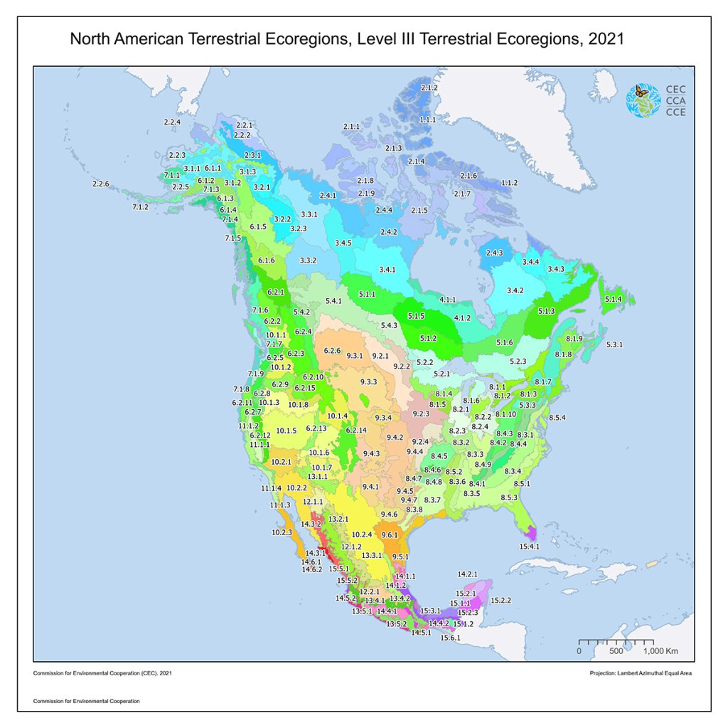
For us in the Outaouais, the three levels are:
Level I
(Mixedwood Plains)
identifies our broad temperate climate;
Level II
(Great Lakes-St. Lawrence)
narrowed down to our specific forest type where northern and southern trees meet;
Level III
(Lower Gatineau Depression)
is the hyper-local valley floor, identifying the plants most perfectly adapted to our dirt.
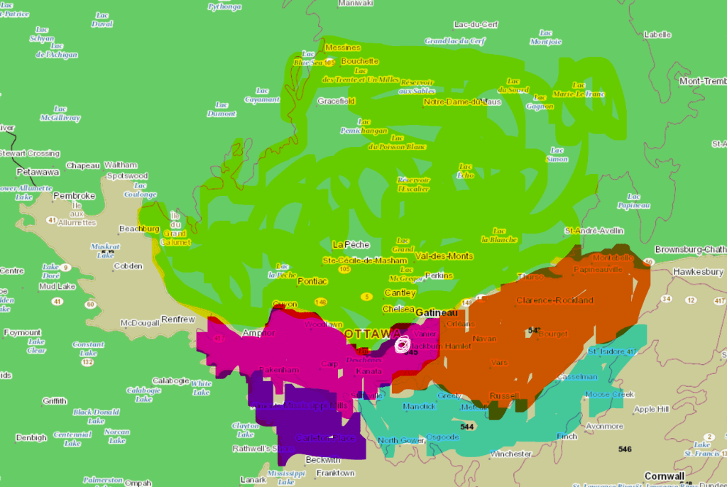
Aylmer, Quebec: An “Ecological Crossroad“
Aylmer sits right at the edge of multiple landscapes. Our nursery is located with the Lower Gatineau Depression (L’unité de référence écologique de la Basse-Gatineau), and though our borders are defined by land, we have ecologically diverse immediate neighbours.
- To our North and East: the rugged Laurentian Highlands.
- To our South and West: flatter, fertile St. Lawrence Lowlands and the Ottawa Valley plains.
Because we sit at this meeting point, we see an overlap species from the forest and the valley.
Localeaf Proximity Scale
Using this information, we are piloting categorizing every plant we grow using a Proximity Scale (0 to +5) based on ecological ecoregions rather than political borders.
How to Read the Scale
Instead of a simple “yes/no” native tag, we are able to use the following scale to understand exactly how locally adapted a plant’s genetics are to our specific dirt in the Gatineau Valley:
| Level | Classification | The Ecological Distance |
| [0] | Hyper-Local | Indigenous to our specific Lower Gatineau Depression eco-region. These plants have evolved for our exact soil and micro-climate. |
| [+1] | Immediate Neighbor | Native to an adjacent eco-region. This includes the Ottawa Valley flats just across the river or the edge of the Pontiac. These are our “next-door neighbors.” |
| [+2] | Regional (QC & Eastern ON) | Native to the broader Eco-province. These species are found naturally within our general latitude in Quebec or Eastern Ontario but may not be historical residents of the Gatineau hills. |
| [+3] | Extended Range | Native to the Northeastern Deciduous Forest or North American Prairies. These are “ecological movers”—species native to the continent that provide high value to pollinators but are naturally found further South or West. |
| [+4] | Continental Outlier | Native to North America, but from a distant ecosystem. This includes species from the BC Coast or the Deep South—sharing a continent but evolving in a vastly different climate. |
| [+5] | Functional / Global | Species from outside North America. We keep these to a minimum, and mostly for our own purposes, focusing on fruit-bearing plants or culinary herbs that provide high edible value to our home garden. |
Why This Matters – Informed Choice
By choosing a Level 0 plant, you are planting to preserve the specific genetic heritage of the Outaouais. By choosing a Level +3, you might be helping a high-impact species “migrate” in response to warming temperatures. This scale doesn’t tell you what to plant—it gives you the data to decide what role your garden should play in the larger ecosystem.
We aim to make this information available for every species we are growing this year. You can see this proximity score next to each of the species listed in our 2026 Species List catalogue.
See the list of plants we are growing, with their relative proximity assigned
Methodology and Sources
We used the support of Google Gemini in performing the extensive boundary research required to map each of the species of seed we are growing against the North American Environmental Atlas
Below are the data sources used in the research
1. Ecological Mapping & Provenance
These sources define the ecoregions used to determine the “Biological Home Address” of our plants.
- Commission for Environmental Cooperation. (1997). Ecological regions of North America: Toward a common perspective. CEC Secretariat.
- Commission for Environmental Cooperation. (2024). North American Environmental Atlas [Interactive map]. http://www.cec.org/tools-and-resources/north-american-environmental-atlas
2. Botanical Biodiversity & Distribution
These databases are the primary records for where plants grow natively in Canada.
- Brouillet, L., Coursol, F., Meades, S. J., Favreau, M., Anions, M., Bélisle, P., & Desmet, P. (2010+). VASCAN: The Database of Vascular Plants of Canada. http://data.canadensys.net/vascan/
- Canadensys. (2024). Explorer: Specimens and observations from across Canada. https://explorer.canadensys.net/
- Flora of North America Editorial Committee (Eds.). (1993+). Flora of North America north of Mexico (22+ vols.). Oxford University Press.
3. Conservation & Rarity Status
These governmental records provide the “S-Ranks” (S1–S5) used to identify at-risk species in Quebec and Ontario. We are working toward verifying and being able to provide these details for all of the plants we are growing from seed this year, and additional species moving forward.
- Gouvernement du Québec. (2024). Liste des espèces floristiques menacées ou vulnérables au Québec. Ministère de l’Environnement, de la Lutte contre les changements climatiques, de la Faune et des Parcs. https://www.quebec.ca/agriculture-environnement-et-ressources-naturelles/flore/especes-floristiques-menacees-ou-vulnerables/liste-especes
- Ministry of Natural Resources and Forestry. (2024). Natural Heritage Information Centre (NHIC): Species of conservation concern. Government of Ontario. https://www.ontario.ca/page/natural-heritage-information-centre
